
Local Tsunami Early Warning System for High Risk Coastal Communities of the Philippines
- Tsunami Early Warning System in Philippines
- Flood alert sirens for Chesil Beach with the Environment Agency
- Case Study: Concept Systems use E2S's unique Appello sounders to improve safety at sea
- Case Study: Wembley Stadium Construction Site Warning System
- Tsunami Evacuation Alert System: City of Penco, Chile
- Network Rail: Appello alarm horn sounders assist with level crossing safety
- Port of Felixstowe: upgrading audible signals with the E2S Hootronic range
Saving lives in the event of a Tsunami.
Some coastal locations facing the Manila trench in the Philippines are particularly exposed in the event of a tsunami. To mitigate significantly the risk of such disastrous event the Philippine Institute of Volcanology and Seismology (PHIVOLCS) in association with the Advanced Science and Technology Institute (ASTI) devised and implemented a Tsunami Detection and Early Warning System (TeWS).
Project TeWS is a cost-effective and reliable system for tsunami forecasts and timely disaster response consisting in a local tsunami warning system directed at alerting selected coastal communities in a timely way so that evacuation plans can be carried out with plenty of notice and save lives.
The project also includes capacity-building activities such orientation on earthquakes and tsunami concepts, familiarisation of tsunami hazard maps and preparation of tsunami evacuation plans.
After being implemented in densely populated coastal towns and cities of Metro Manila such as Subic Bay, Lingayen Gulf, Batangas Bay, Manila Bay, Albay Gulf, Bislig Bay, and Saranggani Bay, TeWS has been extended to various coastal zones in Western Visayas.
How the system works
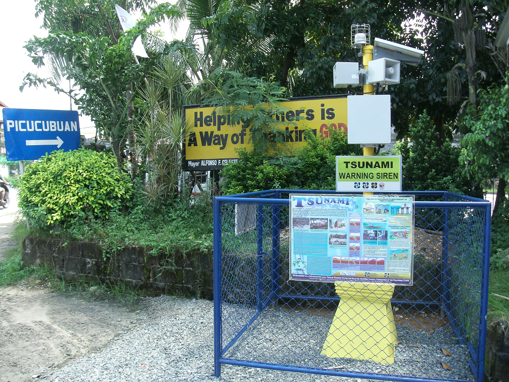
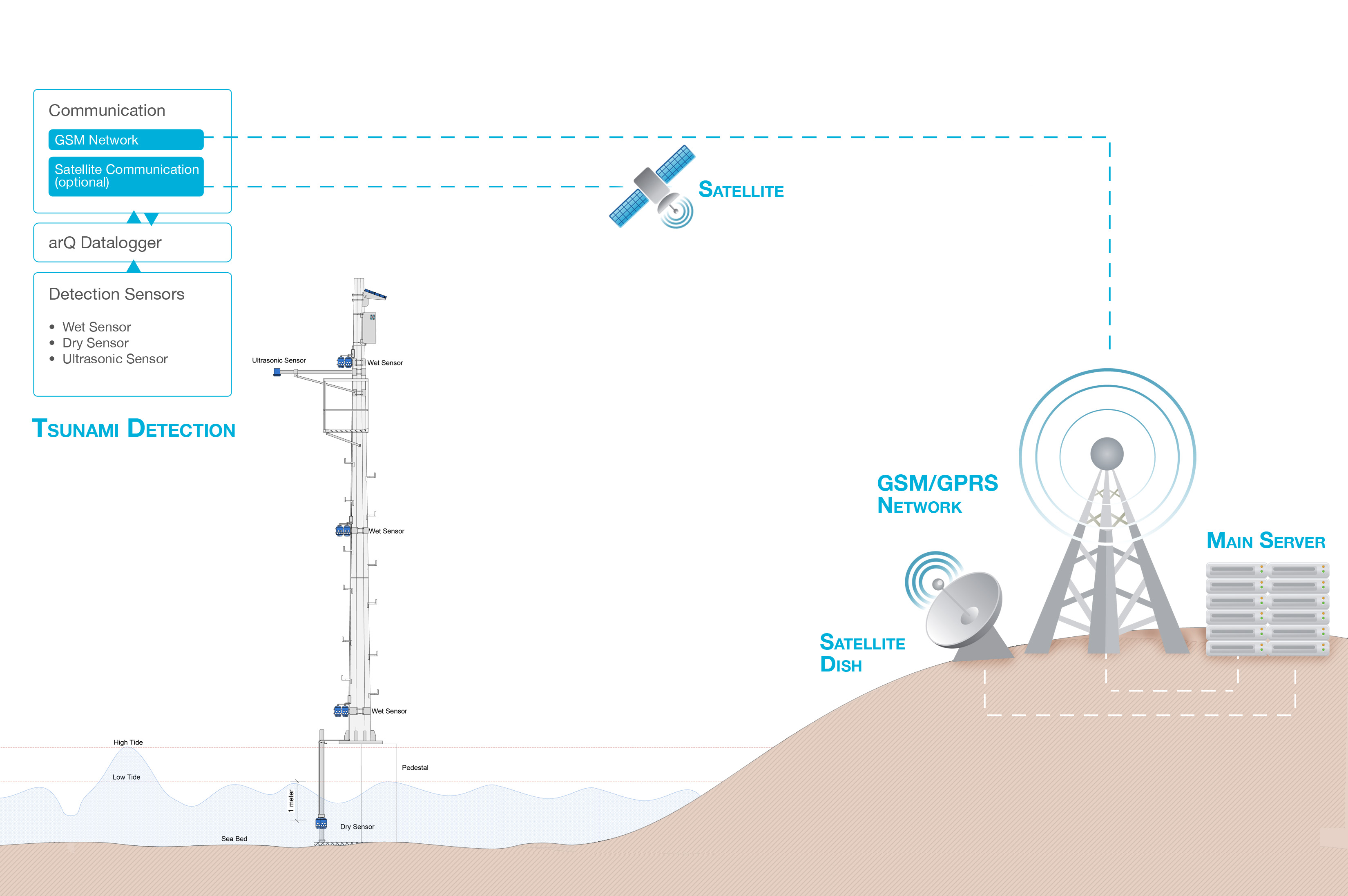
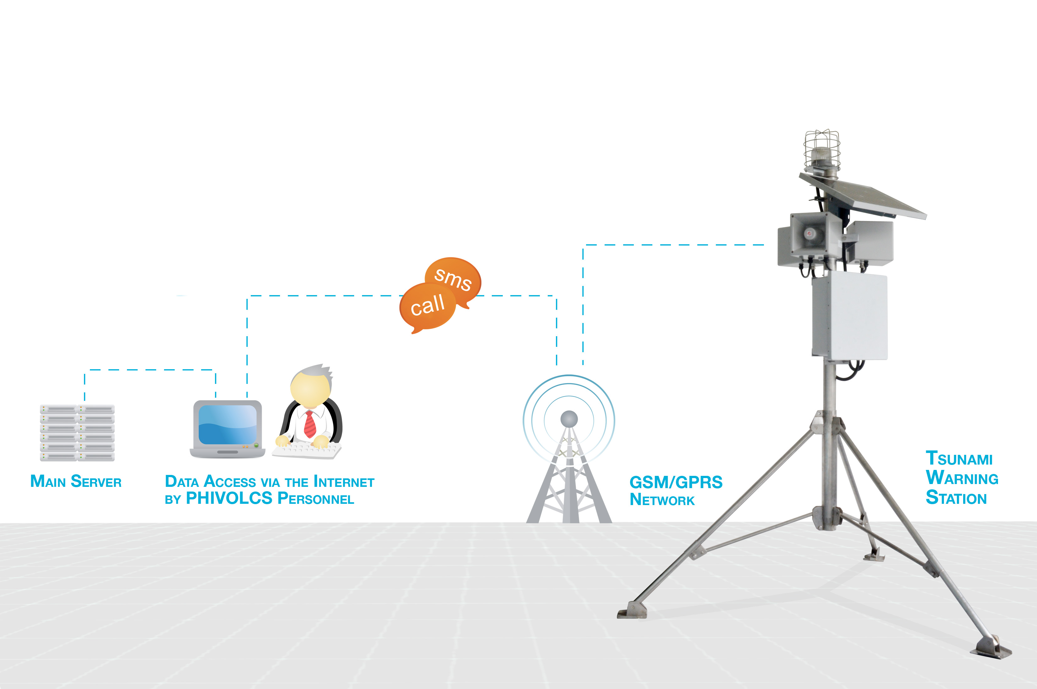
The components of the system include detection sensors, a data communication system using GSM data communication modules, data visualisation, interpretation, local tsunami emergency decision tools and tsunami warning stations equipped with GSM-activated A121 AX Appello warning sirens.
Ultrasonic tide gauge sensors, which detect sudden rise and fall of sea level, and ‘dry’ and ‘wet’ sensors, detecting post-earthquake receding waters, are placed offshore on up to 15-metre high poles (see diagram below).
flee their homes following designated evacuation paths leading to higher grounds (see diagram below).
A versatile and sustainable project
In case the GSM-GPRS communication network is down, the system will automatically switch on the redundant satellite module to provide the communication.
Furthermore, the system can also be used to warn of other natural calamities such as Lahar flow, typhoon, flash flood, and land slide, among others through minor tweaks in the program.
For sustainability, both the sensors and the tsunami warning stations are solar powered. In addition, instead of using expensive satellite communication system, GSM-GPRS data communication modules developed by ASTI will be used to substantially lower down the cost of the tsunami detection network.
Further information about the Appello range can be found here.
All images and diagrams courtesy of Advanced Science and Technology Institute (DOST-ASTI)
.png)